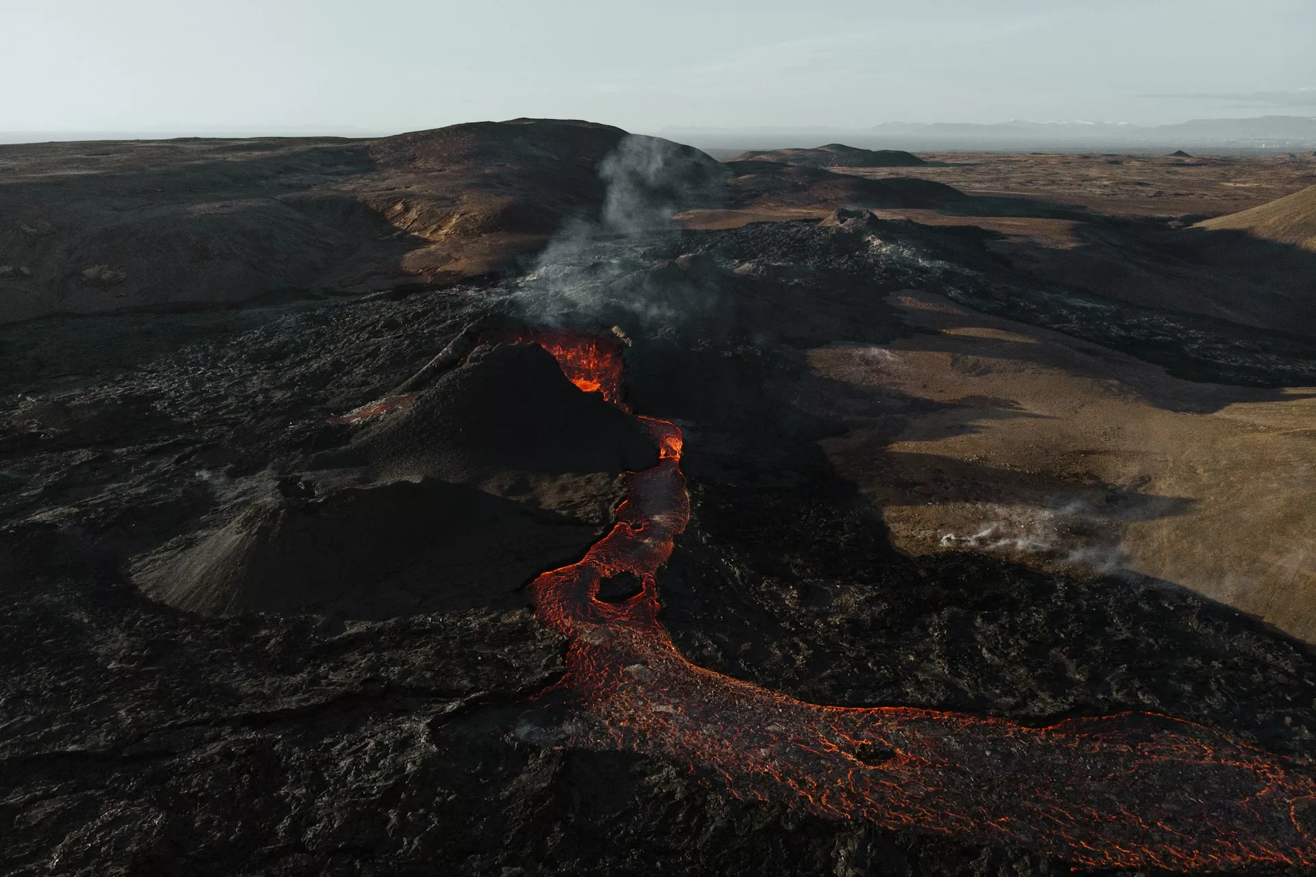
As Iceland sits upon a fault line, its recent eruption was imminent. However, early warnings may have mitigated the extent of damage caused. Photo credit: Deborah Diem via Unsplash
At 22:17 on the 18th of December, following a flurry of seismic activity, the volcanic eruption that Iceland had been waiting weeks for finally began. Overnight, just north-east of Hagafell Mountain, southwest Iceland, the ground unzipped, with spectacular lava fountains turning the night sky red.
Early warnings
Iceland sits upon the Mid-Atlantic Ridge, an enormous fracture in the Earth’s crust that bisects the Atlantic Ocean and is responsible for the Atlantic’s gradual opening and expansion over the past 175 million years.
The Eurasian and North American plates are slowly pulling apart, the thin, brittle crust gliding over the ductile upper mantle. The upper mantle is able to stretch with a toffee-like consistency, unlike the overlying cold crust which can only stretch by breaking.
When these fractures appear, marked by energy release in the form of earthquakes, the hot mantle below depressurises and flows upwards as magma to fill the gaps created.
In the case of the Reykjanes Peninsula, an earthquake swarm began in late October 2023. Increasing seismic intensity and ground swelling near the Svartsengi Power Plant and Blue Lagoon raised further alarm bells, triggering the evacuation of the nearby town of Grindavík on the 10th November.
Scientists believed that the magma began filling a fracture from 5 km in depth before stalling in the crust at less than 1 km from the surface, displacing the ground above and causing the observed swelling.
Spreading lavas
Whilst these signals from the ground meant that the eruption was anticipated, its precise location was uncertain. In the end, the eruption followed an existing fissure, spanning over 4km in length at the height of the eruption. The southernmost end of the fissure was approximately 4.5 km north of the fishing town of Grindavík, and the axis ended just 1.5 km from the Svartsengi Geothermal Power Station, which provides electricity and heating for the entire Reykjanes Peninsula.
The eruption also threatened the Blue Lagoon, one of Iceland’s most popular tourist attractions, a significant source of income for the country.
At the time, the slow-moving lava flows travelled northwards, away from Grindavík, resulting in no damage to the town or its infrastructure—though the unpredictable nature of such flows meant they had to be closely monitored for changes in direction. Before the lava flows ceased, there were fears that they could have overtaken Route 43, the main road connecting Grindavík to Reykjavík and Keflavík Airport, blocking return.
The Icelandic Meteorological Office reported a peak magma flow rate of 100–200 m3 per second—RÚV (Iceland’s national public broadcaster) reports that this rate is up to 20 times greater than previous recent eruptions in the area, including the 2021 eruption at nearby Fagradalsfjall.
The eruption was relatively explosive indicating rapid ascent of the magma in the crust. Jets of magma known as fire fountains reached up to 30m in the air, illuminating the night sky. There was no ash cloud, though significant surface degassing led to a sulphuric cloud of “vog” (volcanic fog) forming locally in the early morning of the 19th of December.
This most recent eruption is in contrast to the famous 2010 Eyjafjallajökull eruption, which resulted in damage to flight infrastructure and closure of western European airspace.
The Eyjafjallajökull eruption was significantly more explosive than this eruption in the Reykjanes Peninsula, causing an ash cloud to form, with rapid cooling of the magma from glacial melting causing the ash to be jagged and highly abrasive to aircraft. This abrasive ash cloud was blown south-westwards and resulted in a perfect storm of factors that caused the European airspace closures.
This is vanishingly unlikely to take place should there be any further eruption on the Reykjanes Peninsula—such ash clouds are unusual for volcanoes in Iceland and are not associated with the type of eruption observed in this setting.
An end to the eruption?
As of the 22nd December, the Icelandic Met Office reported that the eruption has ceased, with some residual liquid lava remaining on the ground. However, ground uplift beneath Svartsengi had then since resumed, indicating magma recharge into the dyke that fed the eruption—indicating that a second phase of the eruption could be imminent, and the hazard assessment for Grindavík remained high.
Construction of lava barriers around the town was accelerated in an effort to increase protections against further lava flows.
…these latest eruptions may mark the beginning a new era on the southwestern peninsula, which has otherwise been dormant for the past 800 years.
This degree of caution was not in vain—on Sunday 14th January, eruptions began again near Grindavík, this time encroaching into the part of the town and destroying a number of houses. Though the existing lava barrier were effective in restraining lava further away from the town, limiting damage, part of the new fissure opened inside the existing lava barriers.
Evacuation of locals meant there are currently no known causalities, but there are worries from some residents that the “town might be over”.
As of the 16th January, the eruption is easing—but with this being the fifth eruption to have taken place along the Reykjanes Peninsula since 2021, pushing the average eruption recurrence from every 5 years to about once a year, these latest eruptions may mark the beginning a new era on the southwestern peninsula, which has otherwise been dormant for the past 800 years.
A testimony to collaboration
Grindavík was evacuated on scientific advice over a month prior to the eruption, where geophysical data indicated an imminent eruption. While it is difficult to predict specifically the timing of an eruption, the fact that there was just an hour and a quarter between the onset of the last seismic swarm and the start of the eruption highlights the importance of heeding early warnings.
The 2019 Whakaari eruption in New Zealand resulted in 22 fatalities, which could have been avoided had scientific advice been followed, and tourism to the island restricted.
…the fact that there was just an hour and a quarter between the onset of the last seismic swarm and the start of the eruption highlights the importance of heeding early warnings.
Ultimately, natural systems are dynamic and unpredictable, and we must encourage collaboration between scientists and government agencies to inform and empower the public to trust in scientific advice.
The decisive evacuation order and its efficacy in the face of such data—there are no known causalities or fatalities from December or January’s eruption—are credits to the Icelandic government and Met Office and set an example to the global community for the importance of the use of scientific data to save lives in the face of natural disasters.